The more capable yet noticeably smaller DJI Dock 2 deploys Matrice 3D or 3TD drones with ease and security. Dock 2 is lightweight, offers high-level operation capabilities, and has cloud-based intelligent functions that bring efficiency and quality to automatic operations.


Lightweight Design
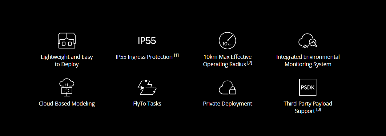
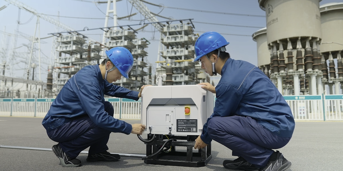
DJI Dock 2 is 75% smaller and 68% lighter than its predecessor and is easily transportable with just two individuals, which makes for flexible installation and reduces installation costs.
Efficient Site Evaluation
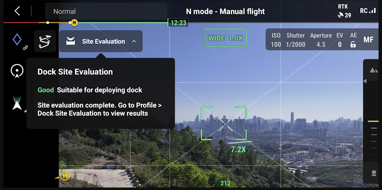
Before deployment, the aircraft can detect the surrounding environment using vision sensors and quickly determine whether the area has strong GNSS signals. [4] This new vision-based evaluation markedly accelerates site selection, reducing the required time from five hours to twelve minutes or less.


Built-In Backup Battery
In the case of an unexpected power outage, DJI Dock 2 can continue to operate independently for over five hours [6] with the built-in backup battery, leaving sufficient time for the aircraft to return and land.
Six-Month Maintenance Interval
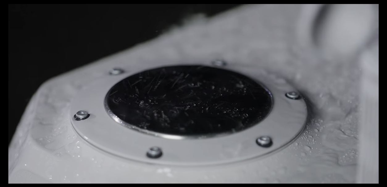
With its high level of protection and reliability, DJI Dock 2 only requires maintenance approximately every six months, [7] effectively controlling human resource costs.
Abnormal Condition Notifications
If DJI Dock 2 and the aircraft encounter task failures or emergencies, DJI FlightHub 2 will immediately send email notifications. This allows operators to accurately trace and troubleshoot problems based on the provided information.
High-Performance Aircraft Models
The all-new DJI Matrice 3D/3TD is specifically designed for DJI Dock 2. Matrice 3D is equipped with both a tele camera and a wide-angle camera with a mechanical shutter, meeting the needs for 1:500 high-precision mapping tasks. Matrice 3TD, outfitted with a wide-angle camera, a tele camera, and an infrared camera, can depict both visible light and thermal images, making it suitable for security and inspection operations.
Cloud Mapping
After the aircraft completes its flight task, DJI FlightHub 2 generates high-precision 3D models based on the collected flight data, authentically restoring the operating environment. These models can be annotated, measured, and downloaded.
Flight Route Editor
Utilizing high-precision 3D models, operators can conduct visual flight route editing from a first-person perspective and preview simulated imaging results. This facilitates intuitive and efficient operations and enhances flight route planning and accuracy.
FlyTo Tasks
DJI FlightHub 2’s FlyTo tasks utilize high-precision 3D models to automatically plan the optimal flight route. Before an urgent task, the operator only needs to click on the subject, and the aircraft will fly to the destination via an efficient and safe route.
Live Flight Controls
Based on DJI FlightHub 2 or a third-party cloud platform, even if
DJI Dock 2 is deployed in a remote region, the operator can still control the flight and gimbal angle via keyboard and mouse.
DJI Dock 2 Overview
The DJI Dock 2 is an advanced, autonomous docking station designed to support fully automated drone operations, perfect for industrial applications, security monitoring, infrastructure inspection, and more. It allows drones to be deployed, charged, and managed remotely, minimizing the need for on-site personnel. Explore the DJI Dock 2 price in Bangladesh.
Key Features:
- Fully Automated Operations: The DJI Dock 2 enables drones to take off, land, and recharge without manual intervention, allowing for continuous, round-the-clock operations.
- Fast Charging: The dock includes rapid charging capabilities, allowing drones to quickly recharge and return to operation with minimal downtime.
- Weather-Resistant Design: Built to withstand harsh environments, the DJI Dock 2 is weatherproof and designed to handle extreme temperatures, rain, and dust, ensuring reliable performance in a wide range of conditions.
- Remote Control and Monitoring: Operators can manage and monitor drones from a remote location via DJI FlightHub, enabling real-time tracking and mission planning from anywhere.
- Precise Positioning: The Dock 2 supports RTK (Real-Time Kinematic) for highly accurate positioning, ensuring precision during automated flights, especially in industrial environments.
- Quick Deployment: With fast setup and easy integration, the DJI Dock 2 is ideal for rapid deployment in industries like energy, telecommunications, and agriculture.
- Seamless Integration: Compatible with various DJI drones, it integrates seamlessly into existing workflows and infrastructure, making it a versatile solution for automated drone management.
The DJI Dock 2 is a robust, automated solution for industries that require frequent and reliable drone operations, reducing human involvement and increasing operational efficiency. It is designed to enhance productivity and streamline processes in various industrial sectors.
Dock – General
Product Name
Total Weight
34 kg (without aircraft)
The actual product weight may vary due to differences in batch materials and external factors.
Dimensions
Dock Cover Opened: 1228×583×412 mm (L×W×H)
Dock Cover Closed: 570×583×465 mm (L×W×H)
The above data does not include the height of the wind speed gauge (145 mm) but includes the height of the mounting base brackets (55 mm).
Input Voltage
Input Power
Operating Temperature
-25° to 45° C (-13° to 113° F)
When the ambient temperature is below -20° C (-4° F), the dock is in standby status, and the aircraft cannot perform flight tasks.
Ingress Protection Rating
Number of Drones Accommodated
Max Allowable Landing Wind Speed
Max Operating Altitude
Receiving Frequency of RTK Base Station Satellite
GPS: L1 C/A, L2
BeiDou2: B1l, B2l, B3l
BeiDou3: B1l, B3l
GLONASS: L1, L2
Galileo: E1, E5B
Positioning Accuracy of RTK Base Station
Vertical: 2 cm + 1 ppm (RMS)
Dock – Charging Performance
Output Voltage
Charging Time
32 minutes
The data was measured when charging the aircraft (when powered off) from 20% to 90% in a 25° C (77° F) environment.
Dock – Video Transmission
Video Transmission System
Operating Frequency
5.725-5.850 GHz
Antenna
Transmitter Power (EIRP)
5.8 GHz: < 33 dBm (FCC); < 14 dBm (CE); < 23 dBm (SRRC)
Dock – Air Conditioning System
Operating Voltage
Air Conditioning Type
Dock – Backup Battery
Battery Capacity
Output Voltage
Battery Type
Battery Life
> 5 hours
Measured with a fully charged backup battery in a 25° C (77° F) environment. After a power outage, the dock does not support functions like aircraft charging, air conditioning, dock cover heating, and wind speed gauge heating. Always check malfunctions promptly.
Dock- Network Access
Ethernet Access
Dock – Sensor
Wind Speed Sensor
Rainfall Sensor
Ambient Temperature Sensor
Water Immersion Sensor
In-Cabin Temperature Sensor
In-Cabin Humidity Sensor
Dock – Security Camera (External)
Resolution
Field of View (FOV)
Auxiliary Light
Dock – Security Camera (Internal)
Resolution
Field of View (FOV)
Auxiliary Light
Dock- Lightning Protection
AC Power Port
Ethernet Port
Dock – Supported Software
Applications
Cloud Platform
Third-party cloud platforms (accessed through DJI Cloud API)
Dock – Expansion Capability
Open Protocol
Edge Computing
Aircraft – General
Weight
1410 g
This value includes the weight of the battery, propellers, and a microSD card, but does not include third-party payloads. The actual product weight may vary due to differences in batch materials and external factors.
Max Takeoff Weight
Dimensions
Wheelbase
Left-Right Wheelbase: 359.9 mm
Front-Rear Wheelbase: 291.4 mm
Max Ascent Speed
8 m/s (Sport Mode)
Max Descent Speed
6 m/s (Sport Mode)
Max Horizontal Speed (at sea level, no wind)
Sport Mode: 21 m/s flying forward, 18 m/s flying backward, 16 m/s flying sideways
Max Wind Speed Resistance
During Takeoff/Landing: 8 m/s
Max Takeoff Altitude
Max Flight Time
50 minutes
Measured in a controlled test environment. Specific test conditions are as follows: flying forward at a constant speed of 46.8 kph in a windless laboratory environment at 20 meters above sea level, in photo mode (without photo-taking operation during flight), with Obstacle Avoidance Action set to Off, and from 100% battery level until 0%. Results may vary depending on the environment, actual use, and firmware version.
Max Hovering Time
40 minutes
Measured with the DJI Matrice 3D series drones hovering in a windless environment at 20 meters above sea level and from 100% battery level until 0%. Results may vary depending on the environment, actual use, and firmware version.
Max Operating Radius
10 km
Measured in an environment of approximately 25° C (77° F) with a safe battery level of 25%, ambient wind speed of approximately 4 m/s, round-trip flight speed of approximately 15 m/s, and hovering operation of 10 minutes. Results may vary depending on the environment, actual use, and firmware version.
Max Flight Distance
43 km
Measured with DJI Matrice 3D/3TD flying at a constant speed of 54 kph in a windless environment at 20 meters above sea level and from 100% battery level until 0%. Results may vary depending on the environment, actual use, and firmware version.
Max Pitch Angle
25° (Sport Mode)
Max Angular Velocity
Global Navigation Satellite System
Hovering Accuracy Range (windless or breezy)
Vertical:
±0.1 m (with vision positioning)
±0.5 m (with GNSS positioning)
±0.1 m (with RTK positioning)
Horizontal:
±0.3 m (with vision positioning)
±0.5 m (with GNSS positioning)
±0.1 m (with RTK positioning)
Operating Temperature
Ingress Protection Rating
Motor Model
Propeller Model
RTK Module
Beacon
Aircraft – Wide-Angle Camera
Image Sensor
DJI Matrice 3TD: 1/1.32-inch CMOS, Effective Pixels: 48 MP
Lens
DJI Matrice 3D
FOV: 84°
Format Equivalent: 24 mm
Aperture: f/2.8-f/11
Focus: 1 m to ∞
DJI Matrice 3TD
FOV: 82°
Format Equivalent: 24 mm
Aperture: f/1.7
Focus: 1 m to ∞
Lens Defogging
DJI Matrice 3TD: The wide-angle camera supports lens defogging.
ISO Range
DJI Matrice 3TD: 100-25600
Shutter Speed
DJI Matrice 3D
Electronic Shutter: 8-1/8000 s
Mechanical Shutter: 8-1/2000 s
DJI Matrice 3TD
Electronic Shutter: 8-1/8000 s
Max Image Size
DJI Matrice 3TD: 8064×6048
Still Photography Modes
DJI Matrice 3D
Single: 20 MP
Timed: 20 MP, 0.7/1/2/3/5/7/10/15/20/30/60 s
Smart Low-Light: 20 MP
Panorama: 20 MP (raw image); 100 MP (stitched image)
DJI Matrice 3TD
Single: 12 MP, 48 MP
Timed: 12 MP, 48 MP, 0.7/1/2/3/5/7/10/15/20/30/60 s*
Smart Low-Light: 12 MP
Panorama: 12 MP (raw image); 100 MP (stitched image)
* The 0.7s and 1s intervals are not supported when taking 48MP timed photos.
Video Resolution
4K: 3840×2160@30fps
FHD: 1920×1080@30fps
Video Bitrate
DJI Matrice 3D
4K: 130 Mbps
FHD: 70 Mbps
DJI Matrice 3TD
4K: 85 Mbps
FHD: 30 Mbps
Supported File System
Photo Format
Video Format
Aircraft – Tele Camera
Image Sensor
Lens
Format Equivalent: 162 mm
Aperture: f/4.4
Focus: 3 m to ∞
Lens Defogging
DJI Matrice 3TD: The tele camera supports lens defogging.
ISO Range
DJI Matrice 3TD: 100-25600
Shutter Speed
Max Image Size
Photo Format
Video Format
Still Photography Modes
DJI Matrice 3D
Single: 12 MP
Timed: 12 MP, 0.7/1/2/3/5/7/10/15/20/30/60 s
Smart Low-Light: 12 MP
DJI Matrice 3TD
Single: 12 MP
Timed: 12 MP, 0.7/1/2/3/5/7/10/15/20/30/60 s
Smart Low-Light: 12 MP
Video Resolution
4K: 3840×2160@30fps
FHD: 1920×1080@30fps
Video Bitrate
DJI Matrice 3D
4K: 130 Mbps
FHD: 70 Mbps
DJI Matrice 3TD
4K: 85 Mbps
FHD: 30 Mbps
Digital Zoom
Aircraft – Infrared Camera (DJI Matrice 3TD)
Thermal Imager
Pixel Pitch
Frame Rate
Lens
FOV: 61°
Format Equivalent: 40 mm
Aperture: f/1.0
Focus: 5 m to ∞
Do not expose the infrared camera lens to strong sources of energy, such as the sun, lava, or a laser beam. Otherwise, the camera sensor may be burned, leading to permanent damage.
Sensitivity
Temperature Measurement Method
Temperature Measurement Range
0° to 500° C (32° to 932° F, Low Gain Mode)
Palette
Photo Format
R-JPEG (16-bit)
Video Resolution
UHR Infrared Image Mode: 1280×1024@30fps (With the UHR Infrared Image function enabled, the aircraft can automatically enable or disable UHR Infrared Image mode according to the ambient light brightness.)
Video Bitrate
Video Format
Still Photography Modes
Single
Normal Mode: 640×512
UHR Infrared Image Mode: 1280×1024
Timed
Normal Mode: 640×512, 0.7/1/2/3/5/7/10/15/20/30/60 s
UHR Infrared Image Mode: 1280×1024, 0.7/1/2/3/5/7/10/15/20/30/60 s
Digital Zoom
Infrared Wavelength
Infrared Temperature Measurement Accuracy
Aircraft – Gimbal
Stabilization
Mechanical Range
Roll: -45° to +45°
Pan: -27° to +27°
Controllable Range
Pan: Not controllable
Max Control Speed (tilt)
Angular Vibration Range
Aircraft – Sensing
Sensing Type
The aircraft supports six-directional obstacle sensing.
The aircraft has a 10° blind spot in the upper rear area. Always fly with caution.
Forward
Detection Range: 0.5-200 m
Effective Sensing Speed: Flight Speed ≤ 15 m/s
FOV: Horizontal 90°, Vertical 90°
Backward
Effective Sensing Speed: Flight Speed ≤ 12 m/s
FOV: Horizontal 90°, Vertical 90°
Lateral
Effective Sensing Speed: Flight Speed ≤ 10 m/s
FOV: Horizontal 104°, Vertical 90°
Upward
Effective Sensing Speed: Flight Speed ≤ 6 m/s
FOV: Front and Back 90°, Left and Right 90°
Downward
Effective Sensing Speed: Flight Speed ≤ 6 m/s
FOV: Front and Back 95°, Left and Right 110°
Operating Environment
Downward: Diffuse reflective surface with diffuse reflectivity > 20% (e.g. walls, trees, people) and adequate lighting (lux > 15)
Aircraft – Video Transmission
Video Transmission System
Live View Quality
540p/30fps, 720p/30fps, 1080p/30fps (with DJI FlightHub 2)
Operating Frequency
2.4000-2.4835 GHz
5.150-5.250 GHz (CE: 5.170-5.250 GHz)
5.725-5.850 GHz
In some countries and regions, the 5.1GHz and 5.8GHz frequency bands are prohibited, or the 5.1GHz frequency band is only allowed for indoor use. Please refer to local laws and regulations for more information.
Max Transmission Distance (unobstructed, free of interference)
DJI Matrice 3D
FCC: 15 km
CE: 8 km
SRRC: 8 km
MIC: 8 km
DJI Matrice 3TD
FCC: 15 km
CE: 8 km
SRRC: 8 km
MIC: 8 km
Measured in an unobstructed outdoor environment free of interference. The above data shows the farthest communication range for one-way, non-return flights under each standard. Always pay attention to RTH reminders in DJI FlightHub 2 during your flight.
Max Transmission Distance (unobstructed, with interference)
Strong Interference (dense buildings, residential areas, etc.): 1.5-3 km (FCC/CE/SRRC/MIC)
Medium Interference (suburban areas, city parks, etc.): 3-9 km (FCC), 3-6 km (CE/SRRC/MIC)
Low Interference (open spaces, remote areas, etc.): 9-15 km (FCC), 6-8 km (CE/SRRC/MIC)
Measured with the aircraft flying (without third-party payloads) in unobstructed environments with typical interference. The above data shows the farthest communication range for one-way, non-return flights under each standard. Always pay attention to RTH reminders in DJI FlightHub 2 during your flight.
Max Download Speed
5 MB/s (with DJI Dock 2)
15 MB/s (with DJI RC Pro Enterprise)
Measured in a laboratory environment with little interference in countries/regions that support both 2.4 GHz and 5.8 GHz. Download speeds may vary depending on the actual conditions.
Lowest Latency
The video transmission latency from the dock to DJI FlightHub 2 is affected by the actual network conditions and the computer’s configuration.
Antenna
Transmitter Power (EIRP)
5.1 GHz: < 23 dBm (CE)
5.8 GHz: < 33 dBm (FCC/SRRC), < 14 dBm (CE)
Aircraft – Storage
Supported Memory Cards
U3/Class10/V30 or above is supported. A list of recommended microSD cards can be found below.
Recommended microSD Cards
SanDisk Extreme 32GB V30 A1 microSDHC
SanDisk Extreme PRO 32GB V30 A1 microSDHC
SanDisk Extreme 512GB V30 A2 microSDXC
Lexar 1066x 64GB V30 A2 microSDXC
Kingston Canvas Go! Plus 64GB V30 A2 microSDXC
Kingston Canvas React Plus 64GB V90 A1 microSDXC
Kingston Canvas Go! Plus 128GB V30 A2 microSDXC
Kingston Canvas React Plus 128GB V90 A1 microSDXC
Kingston Canvas React Plus 256GB V90 A2 microSDXC
Samsung PRO Plus 256GB V30 A2 microSDXC
Aircraft – Battery
Capacity
Voltage
Max Charging Voltage
Type
Chemical System
Energy
Weight
Cycle Count
Charging Temperature
Aircraft – Power Adapter
Input
Output Power
Output
Max output power of 100 W (total)
When both ports are used, the power adapter will dynamically allocate the output power of the two ports according to the load power, and the maximum output power of one of the ports is 82 W.
Aircraft – Charging Base
Input
Output
Rated Power
Charging Type
Charging Temperature
Others
Guaranteed software updates until
Contact Us
If you wish to purchase products, please leave your contact information below. We will be in contact with you shortly.


