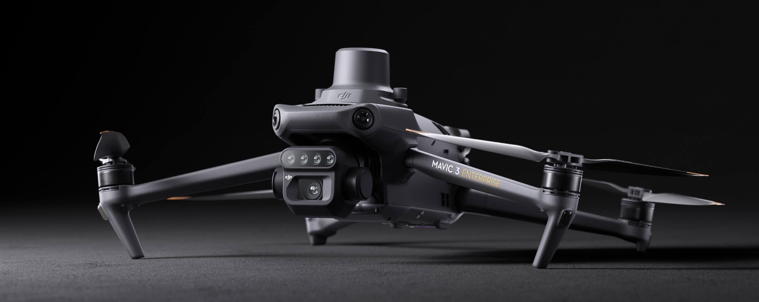
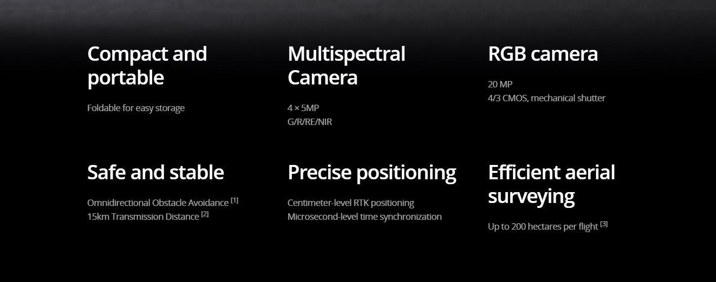
Effective aerial surveying needs to see the invisible. That’s why Mavic 3 Multispectral has two forms of sight. It combines an RGB camera with a multispectral camera to scan and analyze crop growth with total clarity. Agricultural production management requires precision and data, and Mavic 3M delivers both.
Efficient and reliable battery life
Ultra-long battery life, fast bursts
43 minutes
Cruise time
200 hectare
A single flight can complete mapping operations over an area of 200 hectares
Accurate images that capture every pixel
Mavic 3M with RTK module for centimeter-level positioning. Flight control, the camera, and the RTK module sync in microseconds to accurately capture the location of each camera’s imaging center. This enables Mavic 3M to do high-precision aerial surveying without using ground control points.
Contact Us
If you wish to purchase products, please leave your contact information below. We will be in contact with you shortly.